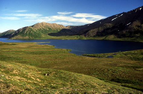
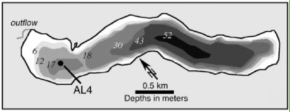
Arolik Lake is located along the southwestern flank of the Ahklun Mountains (59.47°N, 161.13°W), ~100 km northwest of Dillingham on the north side of Bristol Bay. It resides within a trough adjacent to the Goodnews River valley, which was excavated by glaciers into Mesozoic siliciclastic metasedimentary rocks. Arolik Lake is 3.7 km long and 0.6 km wide with a surface area of 2.0 km2, constituting ~20% of the total catchment area. It forms the headwaters of the Arolik River, which flows northwestward to Kuskokwim Bay. The lake surface elevation is 145 m asl. The lake comprises two subbasins: the main subbasin is 53 m deep, forming the elongate axis of the lake; a secondary basin, 18 m deep and separated from the main basin by a minor sill, occupies the outflow (northwestern) end of the lake.
Air, ground, and water temperature loggers have been deployed since July 2003. A weather station, equipped to measure air temperature, relative huimidity, rainfall, barometric pressure, wind speed and direction and solar insolation was deployed in July 2004. All the data are available here.
Arolik Lake temperature data (excel spreadsheet)