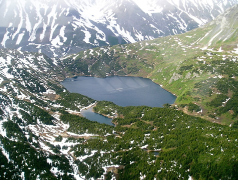
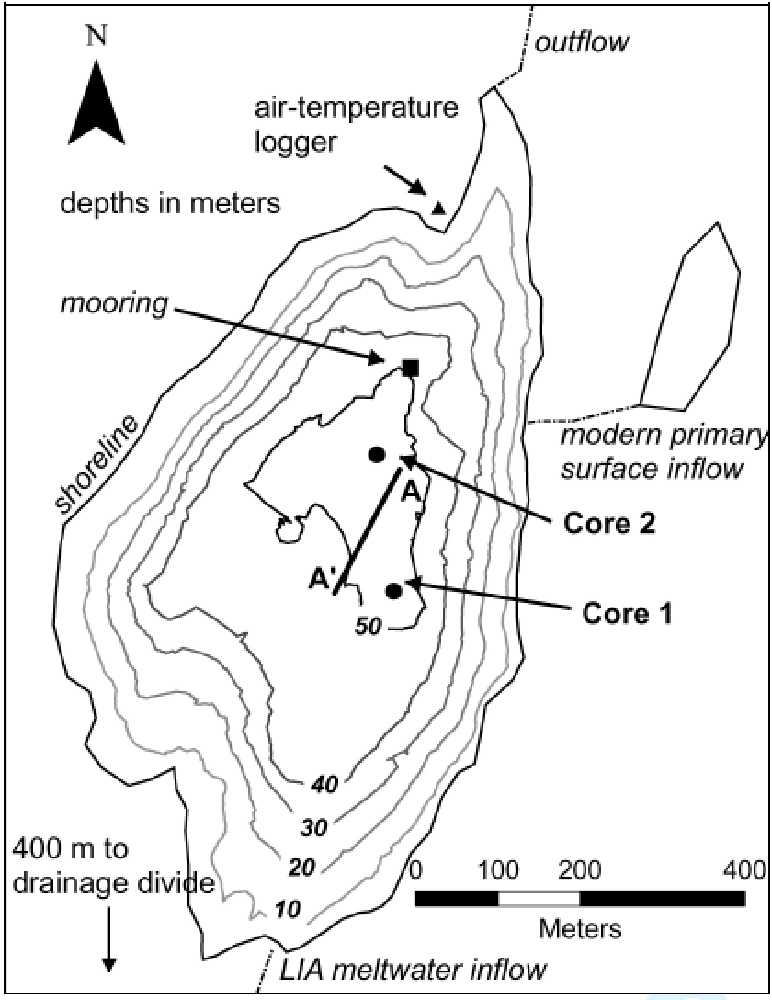
Goat Lake (N 60.2583º, W 149.9083º) is located at 550 m asl in the central Kenai Mountains, about 1 km north of an outlet of the northern Harding Ice Field (HIF), and 45 km northwest of Seward (Fig. 1). The lake (0.38 km2) is 55 m deep and occupies a small catchment (2.82) in an overdeepened, glacially scoured basin (Fig. 2). It is contained by a bedrock sill at the northern outlet, and drains into Upper Russian Lake. The lake currently receives limited perennial surface-water inflow; the main input emanates from a small pond 200 m east of the lake. Mountains summits rise to 1460 m within 5 km from the lake. Vegetation in the Goat Lake drainage basin is dominated by alder (Alnus incana sinuata) with mountain hemlock (Tsuga mertensiana), sitka spruce (Picea hensis), shrub birch (Betula nana), ferns, and grasses.
Two water temperature loggers have been deployed since June 2004; an air temperature logger has been deployed since August 2005. The data (through July 2006) are available here.
Goat Lake temperature data (excel spreadsheet)
Daigle, T.A. 2006. Late Holocene climate change at Goat Lake, Kenai Mountains, south-central Alaska . Master's thesis, Northern Arizona University, Flagstaff, AZ.
Daigle, T.A. and Kaufman, D.S. 2007 (Submitted). Holocene climate inferred from glacier extent, lake sedimentation, and tree rings at Goat Lake, Kenai Mountains, Alaska. Journal of Quaternary Science.