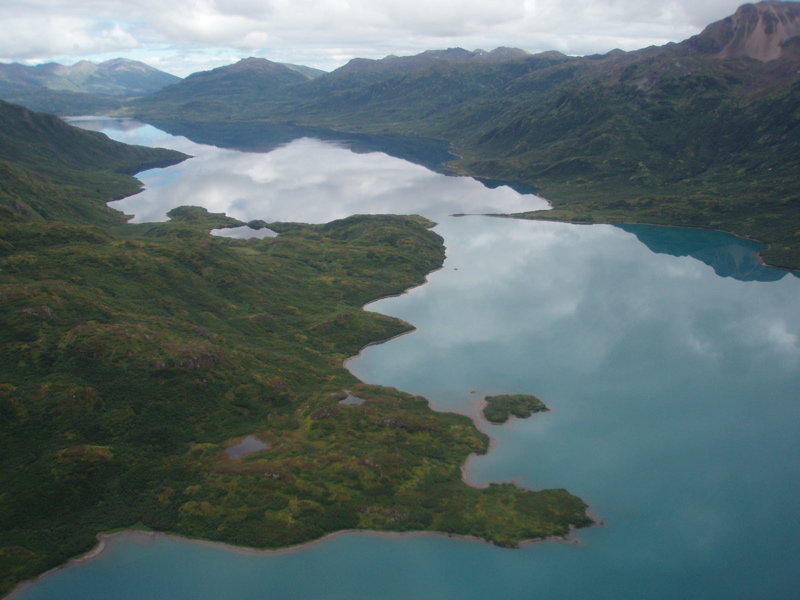
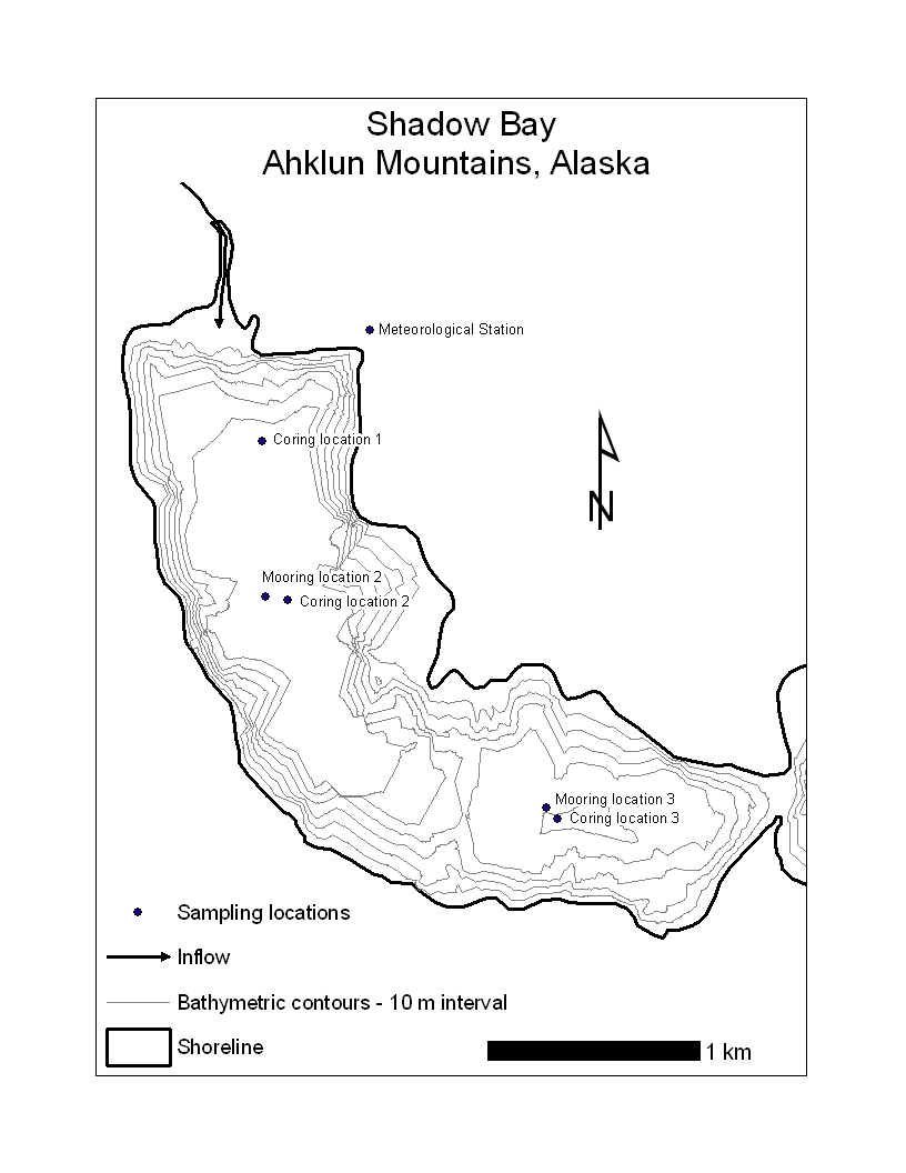
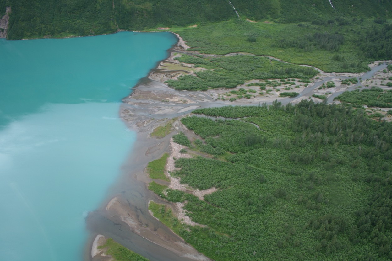
Shadow Bay (60.01°N, 159.18°W) is located at 96 m asl in the northeastern Ahklun Mountains, Alaska. Situated at the west end of Lake Chaeukuktuli, Shadow Bay is a 4.3 km2 sub-basin isolated from the main body of the lake by a c. 2 m deep sill at its east end (bathymetric map). It includes two sub-basins: one 69 m deep and the other 59 m deep. Runoff from a 125 km2 watershed drains into Shadow Bay and approximately 4% of that land area is covered by small glaciers. The majority of water and sediment is delivered to the bay from a braided inflow channel located at the north end of the basin (Shadow Bay inflow).
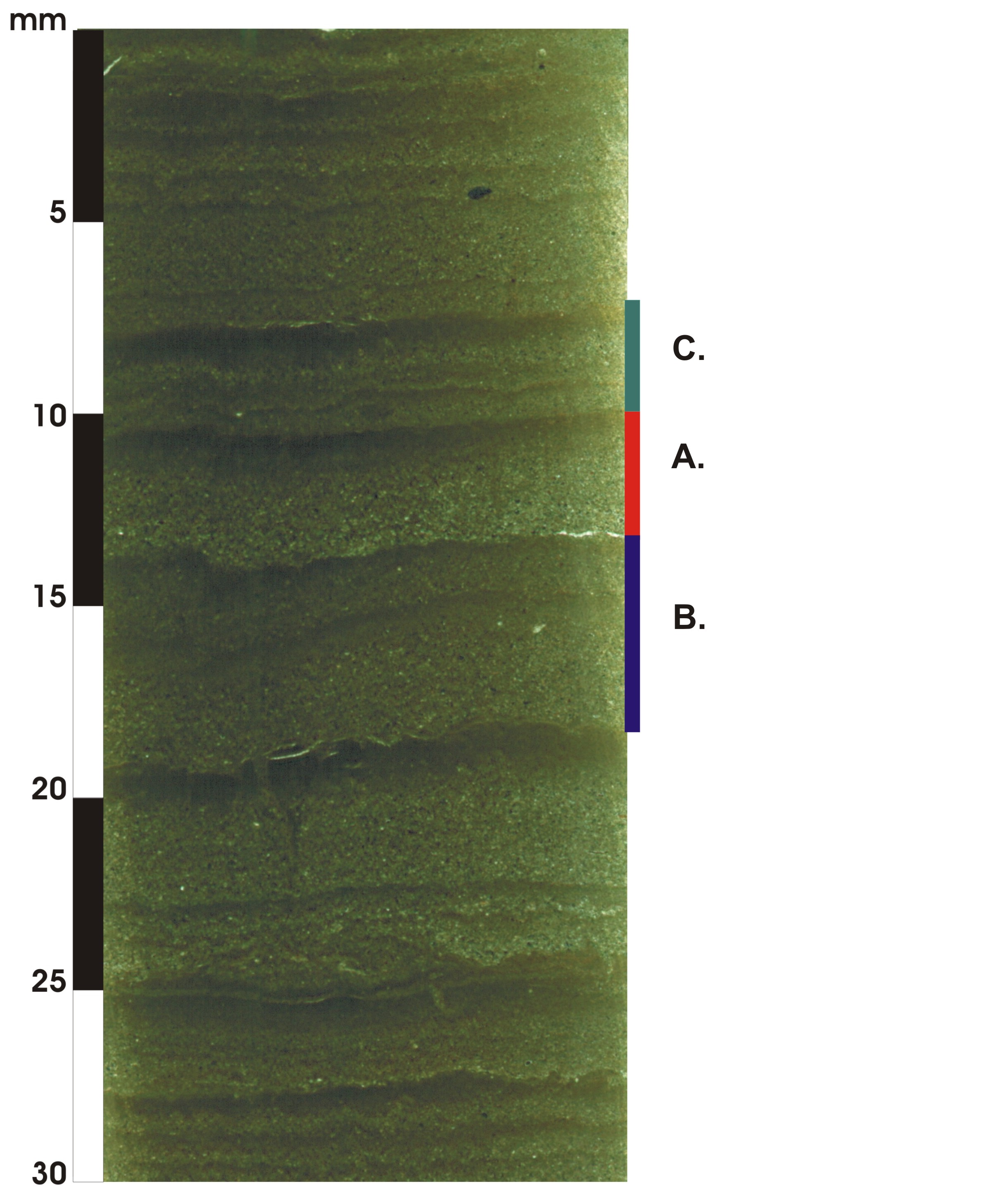
Surface cores collected in 2006 from 69 to 65 m depth exhibit clear laminations. New 137Cs and 239+240Pu analyses show that the interval of peak fallout of these isotopes in 1963 is located about 40 couplets below the surface, confirming the annual timescale of these sedimentary features (4.3 mm yr-1). Varve composition appears to be linked to the hydrological conditions. During years when runoff is dominated by a strong early summer snowmelt peak, varves tend to be “simple,” consisting of a normally graded silt unit overlain by a clay cap (layer A). The silt is deposited during higher-energy summer conditions, while the clay is deposited during lower-energy conditions during the rest of the year. In years when the inflow hydrograph is dominated by a strong early summer snowmelt peak and a fall rainfall peak, varves tend to be “complex” (layer B). In this case, the clay cap is interrupted by an additional layer of silt that is delivered to the lake during fall storm activity. In years when the hydrograph is dominated by a strong early summer snowmelt peak and multiple fall rainfall peaks, the complexity of Shadow Bay varves is further increased, with the clay cap interrupted by multiple pulses of coarse sediment brought in by large precipitation events (layer C).
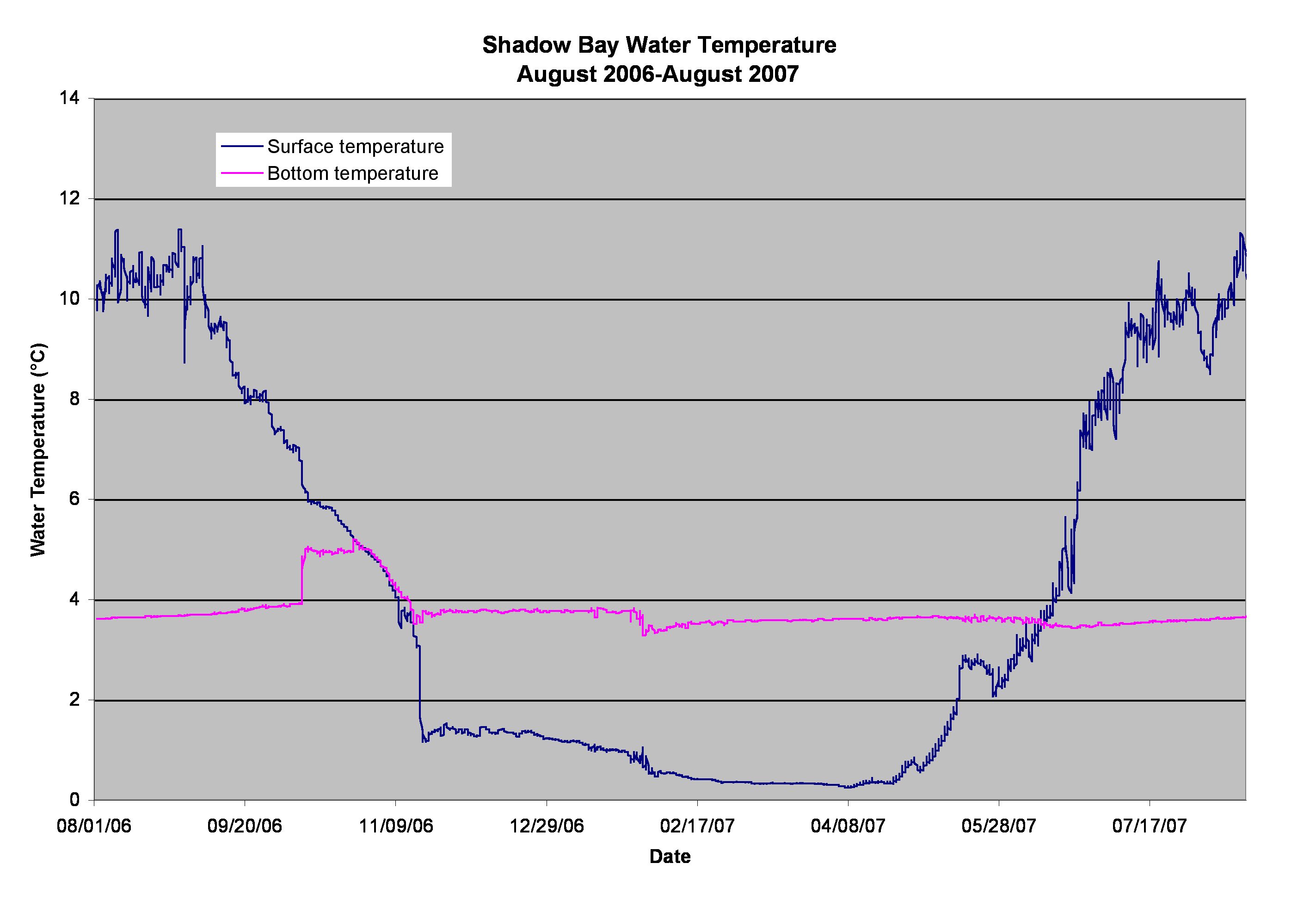
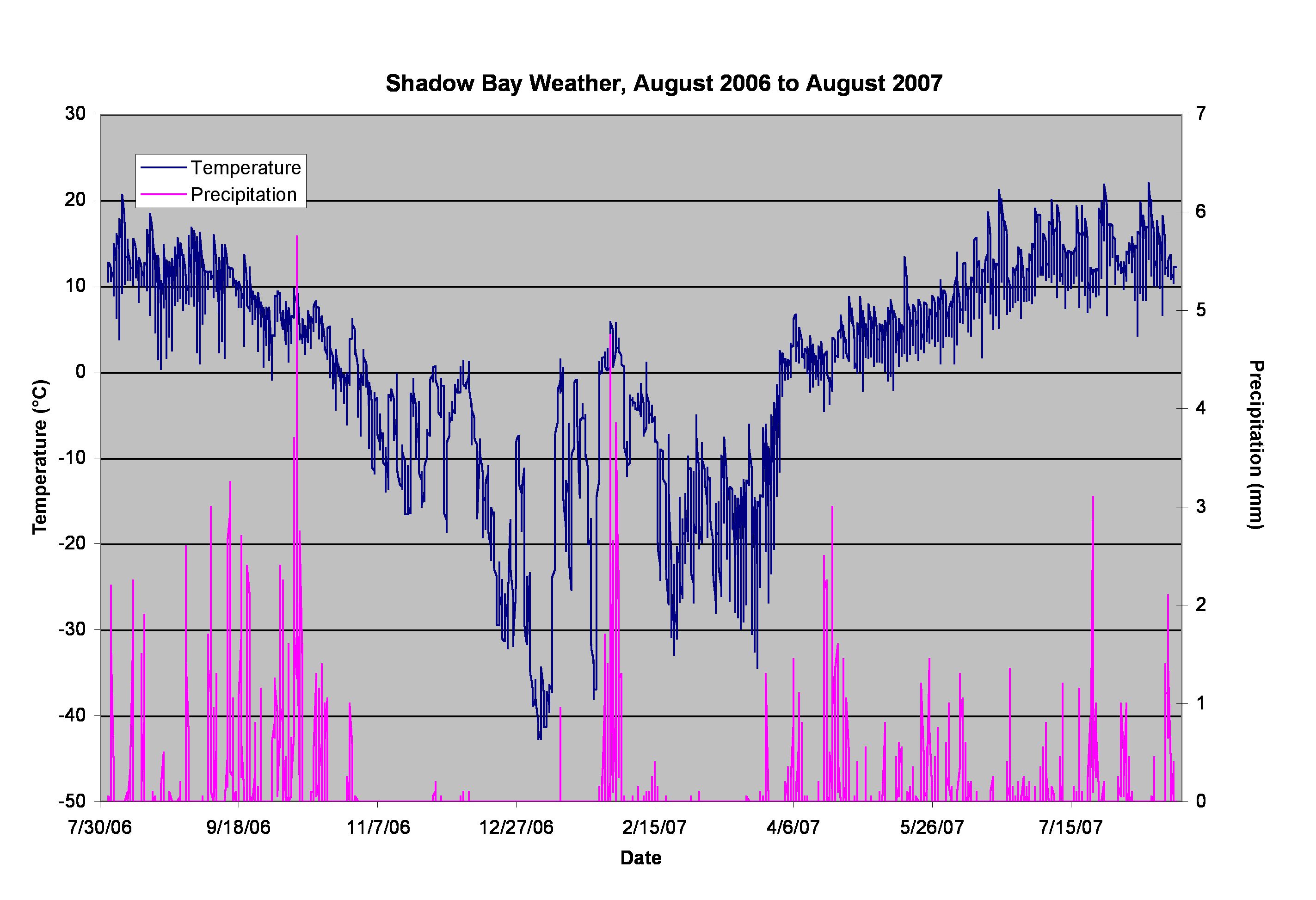
Two water temperature loggers have been deployed at the lake bottom and near the surface since August 2006. A plot of the water-temperature data for 2006-07 is shown here. A meteorological station, equipped to measure temperature, relative humidity and rainfall was deployed in August 2006. A plot of the air temperature and precipitation for 2006-07 is shown here and the hourly data are available here.