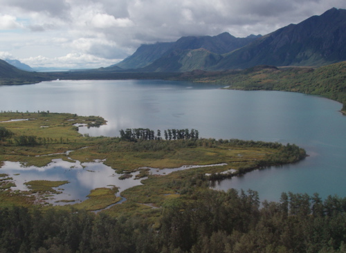
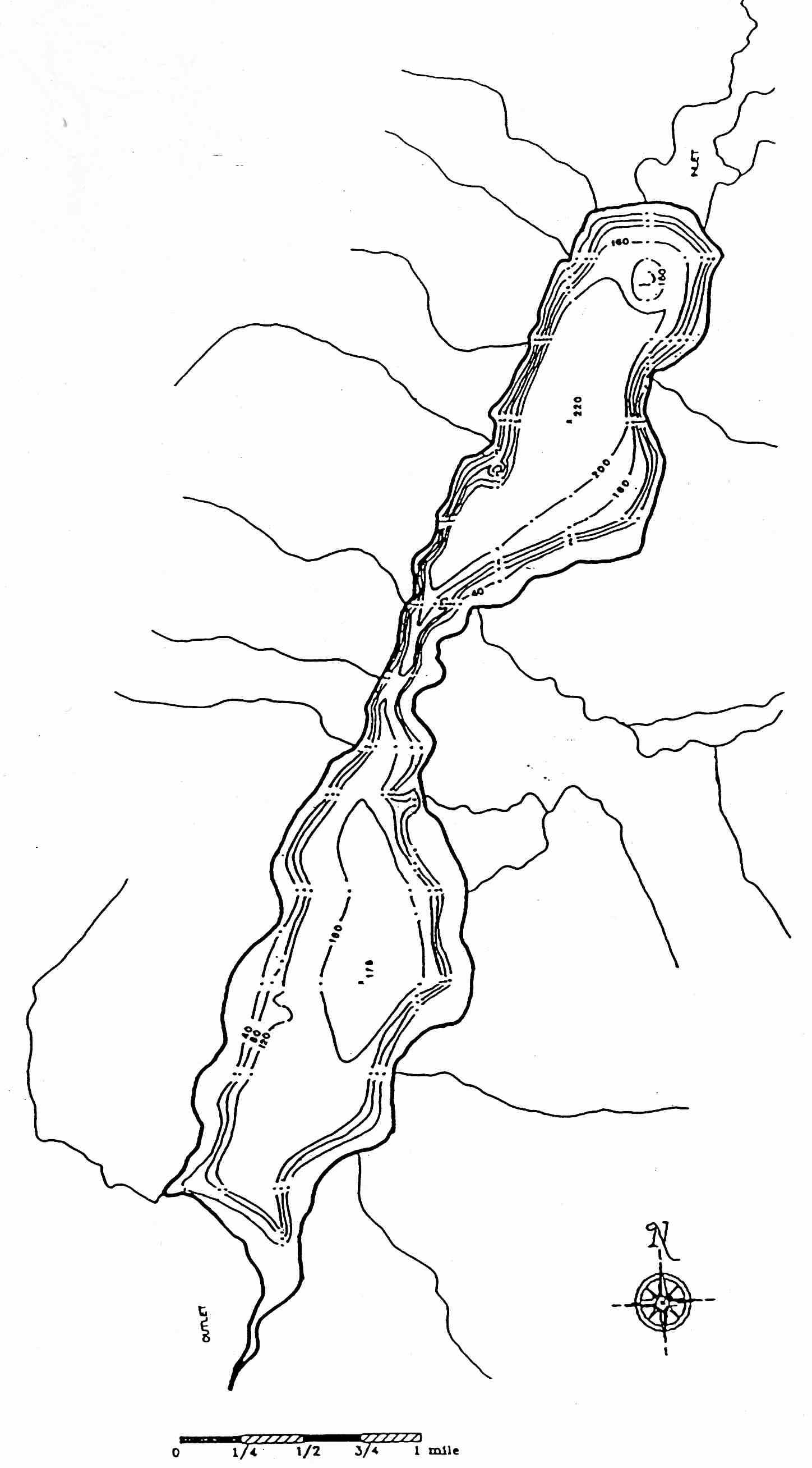
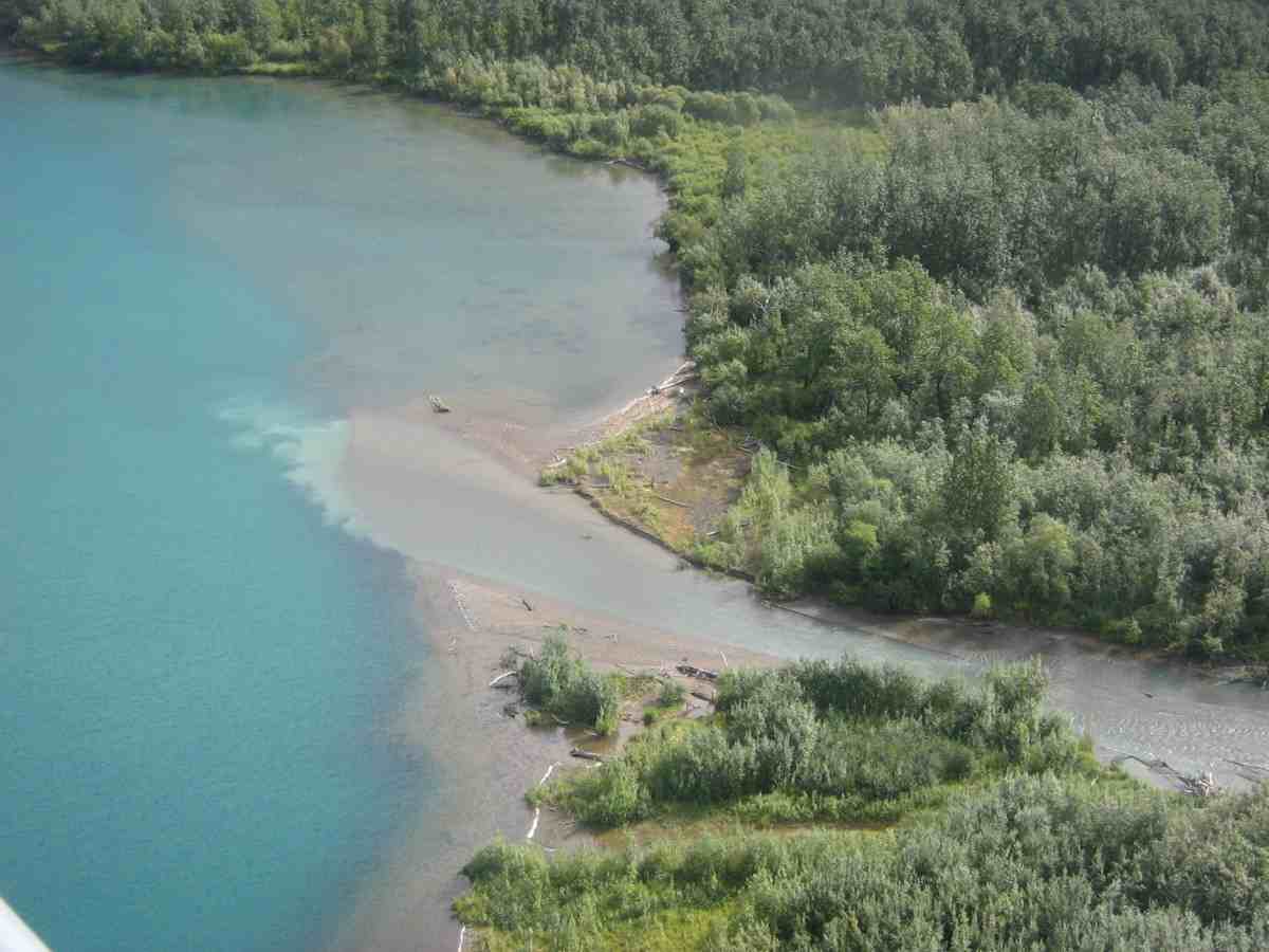
Upper Togiak Lake (59.86°N, 159.35°W) is located at 92 m asl in the northeastern Ahklun Mountains, Alaska. The lake is a 3.2 km2, divided into two main basins isolated from one another by a prograding delta situated at the east-central region of the lake (bathymetric map from US Fish and Wildlife Service). The south basin is 54 m deep and the north basin is 67 m deep. A land area of 125 km2 drains into the north basin and approximately and 3% of that land area is covered by small glaciers. The majority of water and sediment is delivered to the north basin of Upper Togiak Lake from a channel located on the east-central delta (Upper Togiak Inflow); a secondary inflow is located at the north end of the lake.
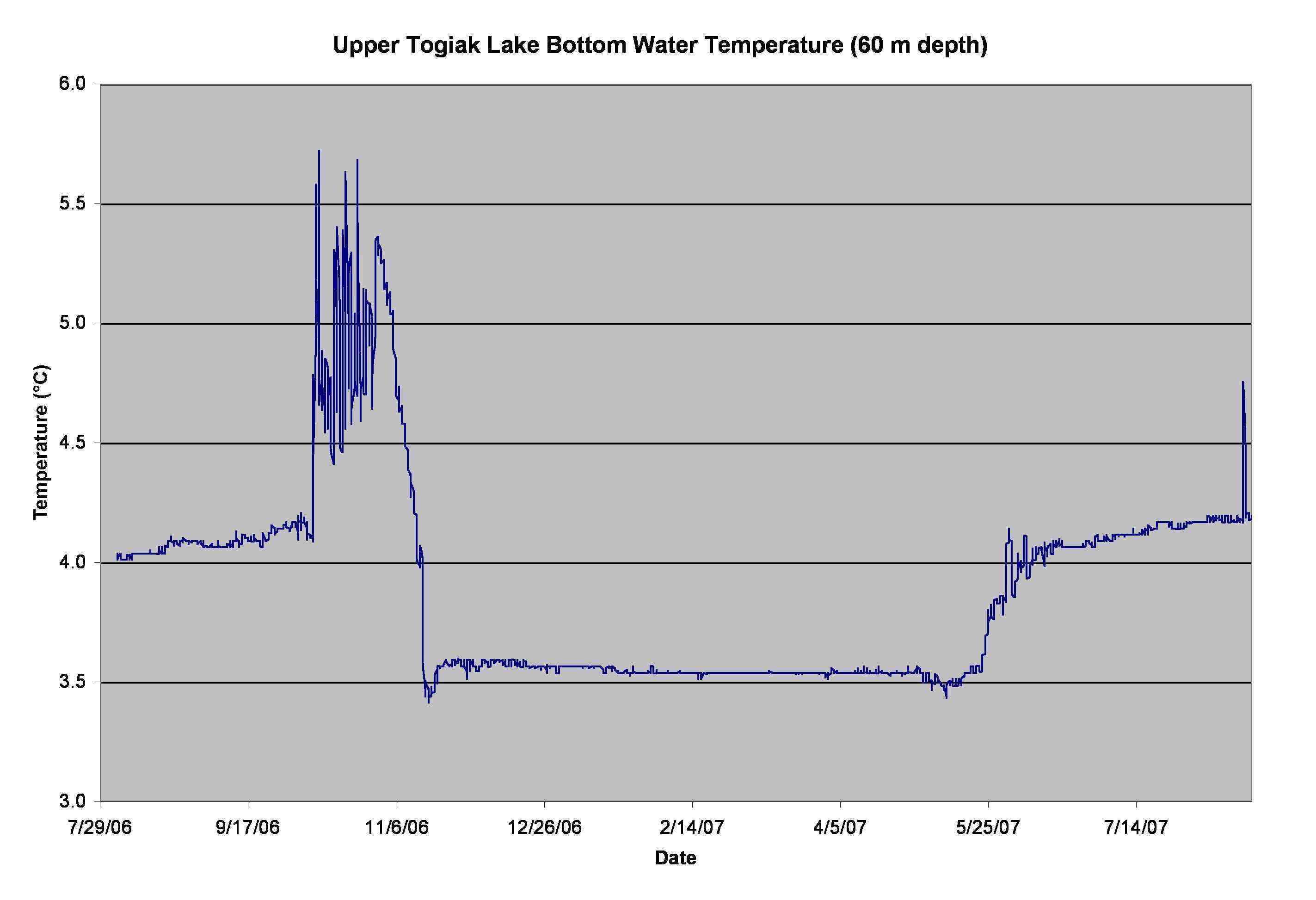
One water temperature logger was deployed at the bottom of the north basin of Upper Togiak Lake since August 2006. A plot of the data are shown here and the data are available here.