Greyling Lake
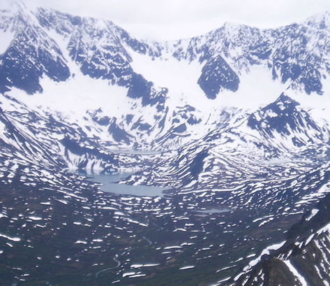
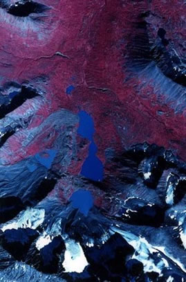
Greyling Lake (61.38N, 145.74W) is located near the crest of Chugach Range in south-central Alaska, at 1015 m asl. The relatively small (0.7 km2), deep (zmax = 36 m) lake is fed by several cirque glaciers, and has three subbasins, from which both higher- and lower-resolution cores have been recovered. The position of the lake makes the sediment record particularly sensitive to Aleutian Low strength. Greyling Lake, along with nearby Hallet Lake are being studied as part of the ARCSS 2 kyr Project.
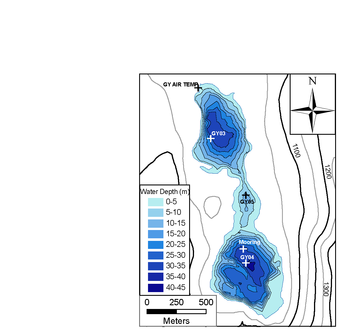
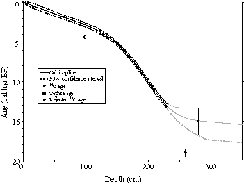
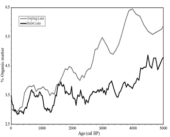
Three cores were recovered from Greyling Lake, core GY05 from the central sub-basin was used for primary analysis. Five radiocarbon ages and two tephra ages were used to develop and age-depth model (below, left), and organic matter was analyzed at a 2.5-cm-interval, and shows strong similarities to OM at Hallet Lake and may be related to Aleutian Low strength over the past several thousand years (below, right).
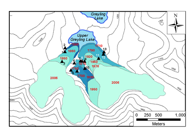
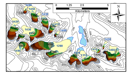
Modern and past glacier extents (as indicated by the prominent neoglacial moraines in the glacier forefields) above Upper Greyling Lake were mapped in July 2006, and lichenometry was used to provide a chronology of past glacier advances (below, left). The area-altitude method was used to calculate equilibrium line altitudes for 16 glaciers near Greyling Lake, and for their Little Ice Age extents (as indicated by the largest neoglacial moraine for the cirques).
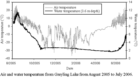
An air temperature logger was deployed at Greyling Lake in August 2005. Two water temperature loggers have been deployed since June 2004. The data are available here.
Greyling Temperature Data (excel spreadsheet)